Product name:
Category:
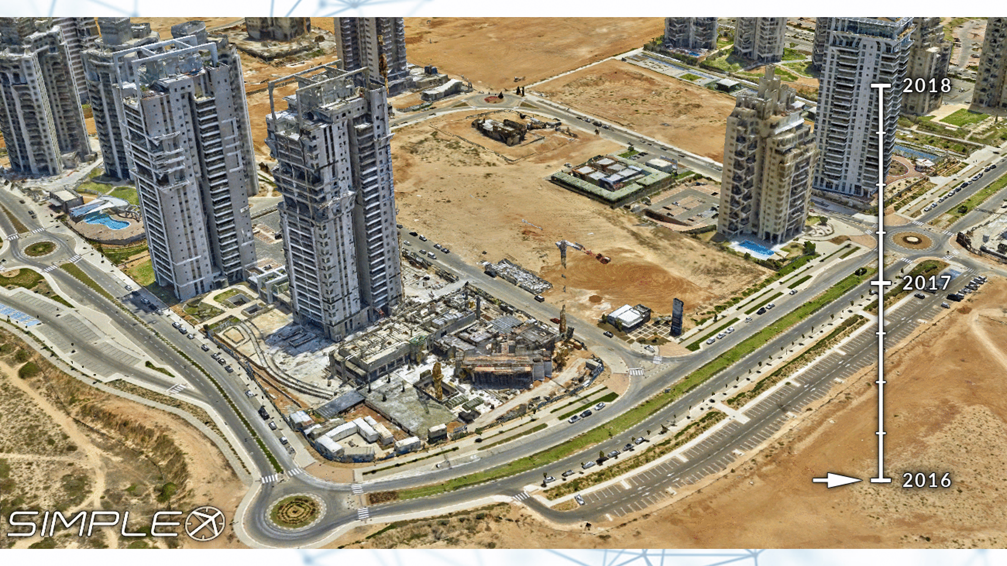
A global provider of wide scale 3D modeling of high resolution imagery (2-3cm per pixel).
Simplex have developed an innovative aerial data collection system and advanced photogrammetric tools.
The system is designed to collect Nadir and Oblique views on one flight pass and was built specifically for the collection of high-resolution 3D imagery and Orthophoto.
The solution includes full 3D mapping and implementation of GIS based tools for urban management and planning systems. The system enables authorities an accurate view and analysis of the city with the highest 3D resolution.
Video
Need a Solution?
Lorem Ipsum is simply dummy text of the printing and typesetting industry.
1500s, when an unknown printer took a galley of type and scrambled
1500s, when an unknown printer took a galley of type and scrambled